|
Club #4216 |
 |
| What's
New?
Click Here for directions to the Flying Site.
Click Here for the current Flying Field Rules.
The club meets the fourth Thursday of every month. Click Here for the meeting schedule.
Click Here for information about upcoming Pylon Racing events
For anyone who may be interested in learning to fly, please contact the club, click here. Plane will be provided if necessary.
|

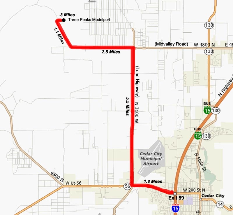
Take I-15 Cedar City exit 59, (middle interchange), and turn West on Highway 56, (200 North).
Travel 1.8 miles and turn right, (North), on the Lund Highway, (3100 West).
Travel 5.5 Miles to the intersection of Lund Highway and Midvalley Road, (4800 North).
Turn left, (West), on Midvalley Road and travel 2.5 miles to the "Loop Road".
NOTE: Look for the sign that designates the turnoff to the "Iron County Shooting Range".
Turn Right, (North), on the Loop road and travel 1.1 Miles to the turnoff to the flying site access road.
Turn Right, (East) and travel .3 miles. That will put you at the entrance to the parking lot of the flying site.
GPS Coordinates: N 37 46.743, W 113 09.560 (37.779042, -113.15933)
Click Here for the Flying Field Rules